|
|
|
Historical Maps of Bloomfield |
|
We are grateful to the Historical Society of Montclair for digitizing these maps and for allowing us to present them on our web site.
|
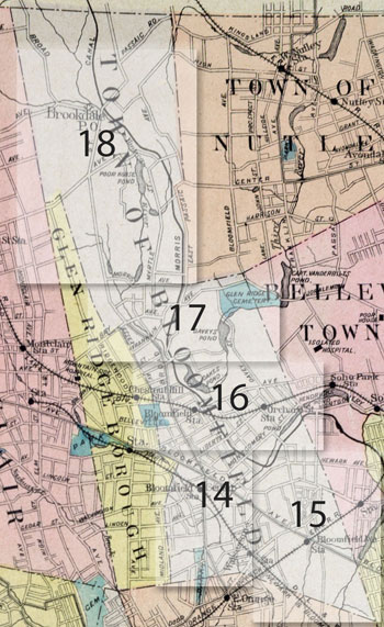
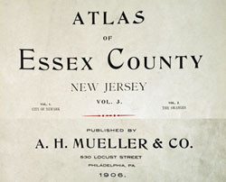
Atlas of Essex County, 1906, A. H. Mueller & Co. |
| Plate 18 | North Bloomfield - Brookdale, Broad Street from Bay Avenue to Clifton border, East Passaic Avenue from Bay Avenue to Clifton Border, Morris Canal from Hoover Avenue (Franklin Avenue) to Clifton/Passaic County border |
| Plate 17 | Central Bloomfield north of Baldwin Street, east side of Broad Street from Baldwin Street to Morris Avenue, Hoover Avenue (Franklin Avenue), Glendale Cemetery (Glen Ridge Cemetery), Davey's Mill and Davey's Pond, Diamond Paper Mill, Combination Rubber Mfg Co, Morris Canal from James Street to East Passaic Avenue, Inclined Plane 11 East |
| Plate 16 | Central Bloomfield north of Liberty Street south of Baldwin Street, Broad Street from Liberty Street to Baldwin Street, The Green, Wrights Field, Belleville Avenue, Oakes Pond, Davey's Pond, Bloomfield Cemetery, Mt Olivet Cemetery (Catholic Cemetery), Morris Canal from Belleville border to Berkeley Avenue (Wrights Field area, formerly Randolph Pond) and from Montgomery Street to Baldwin Street |
| Plate 15 | South east Bloomfield - south of Montgomery Street, south of Orange Street, Bloomfield Ave to Orange Street, Franklin Street, Newark Ave, Berkeley Heights, Halcyon Park, Morris Canal from Baldwin Place to Montgomery Street |
| Plate 14 | South west Bloomfield - Watsessing, Watsessing Park, Bloomfield Center to Liberty Street, Morris Canal from Montgomery Street to Liberty Street. |
 |
|
|
90 Broad Street
Bloomfield, NJ 07003
973-743-8844
info@hsob.org
|